Thanks for your questions!
Just wondering when you consulted environmental groups about the WOW trail extension, and which groups you consulted?
DBCA held a community meeting at the Denmark Riverside Club on 16 March 2021. 73 were invited and 59 were in attendance with representatives from Denmark Rate Payers Association, Denmark Environment Centre, Green Skills, Shire of Denmark, City of Albany, William Bay Rate Payers, William Bay National Park Association, Denmark Bird Group, Denmark Mountain Bike Club, William Bay Snorkel Club, Denmark Trail Running Club, Denmark Community Resource Centre, Denmark Riverside Club, Department Primary Industries & Regional Development (DPIRD) Denmark Office, Bibbulmun Track Foundation volunteers, plus numerous others that were advised, acknowledged but did not attend.
From May 24 2021 DBCA has sent 28 mail chimp newsletters from the Trails WA Projects website to the Denmark and Walpole databases advising of Trail developments in the State with little or no response from Denmark residents.
26 May 2022 Wow Stage 2 Stakeholder meeting held at the Shire Offices and also via teams online. Attendance included DBCA, Shire of Denmark, Denmark Bird Group & Denmark Environment Centre. Invited but were apologies Green Skills & South Coast Bushcare Services . No significant concerns were raised.
Were we given the opportunity to discuss whether it should even go ahead, or were 'stakeholders' only 'consulted' once a decision had been made to do it?
The trail alignment and proposal was identified and approved by Council in 2010 as per the Shire of Denmark Coastal Management Strategy and Action Plan. Stage 1 was commenced and completed in 2016/17 and Stage 2 was waiting on further funding opportunities. Stage 2 was identified in the Council adopted Great Southern Regional Trails Master Plan 2020-2029. The State Government has contributed to funding the WOW Stage 2 Trail Project through the WA Recovery Plan. Stakeholders were informed from the time the funding became available to deliver the Stage 2 project.
Why wasn't constructing a track from the surf club to Sinker Bay given a higher priority,
The current finishing of the WOW at the wind turbine led to people having to make their way out down a steep gravel track to Ocean Beach Road. There were safety concerns raised by young families and older people with some mobility restrictions in regards to the access way and also exiting onto Ocean Beach Road. The WOW stage 2 reduces the need to finish at this point. The Surf Club to Sinker Bay section was originally included in the Stage 2 but due to funding constraints unfortunately cannot be delivered. The Shire will be investigating further funding opportunities to complete this section through to Ocean Beach.
The Heritage report states the following about Stages – supporting Stage 2 as the priority:
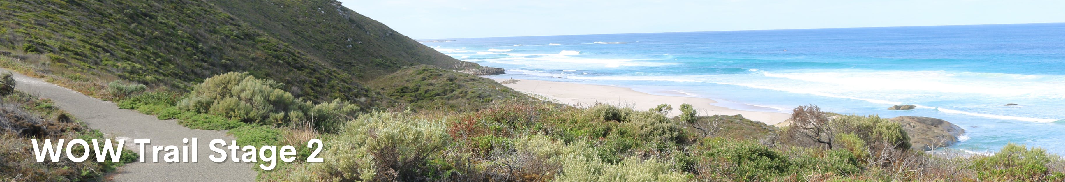
STAGE 2 (WINDFARM TO SINKER BAY)
The harsh landscape and lack of freshwater sources would have made for a low likelihood of the area being a favoured past camping area. Of low archaeological potential.
STAGE 3 (SINKER BAY TO OCEAN BEACH)
A rock shelter (Registered Site 4668 - Katelysia Rock Shelter) close to Prawn Rock Channel on the Denmark River, just to the north of Ocean Beach, has dated occupation. There a very few dated rock shelters on the south coast making the site important and location significant. The steep hills and thick vegetation of Stage 2 change at Sinker Bay. As you travel eastwards and then north along Stage 3 the coast becomes much less steep allowing for easy access. The rock platforms around Black Hole seem the largest and most accessible for shellfish gathering and fishing. Given the proximity of the Denmark River Stage 3 would not have been affected or impacted by the access to freshwater as seen in Stage 2. The available coastal resources and abundant bush tucker species observed in the landscape would have made Stage 3 a much more favourable location for people camping and living in the past of medium to high potential.
CONCLUSION
Stages 2 & 3 of the Denmark WOW Trail are quite different to each other. Stage 2 is an exposed section characterised by steep hills and valleys covered in dense vegetation with steep sheer cliffs. Stage 3 is a more flat, open, and accessible environment. It is rich in native flora species (bush tucker) and has several areas with large rock platforms. The evidence of dated occupation spanning several thousand years just to the north at Katelysia Rock Shelter supports the belief that once cleared and defined a number of places along Stage 3 may contain archaeological & ethnographic evidence of past Aboriginal occupation and use.
and how to you propose to protect the Wilson Head to Walton Point area from over-use?
Good trail design, construction and management ensures that locals and visitors to the Shire can enjoy the natural environment that are already using the area, while reducing the risk to the public and the environment. The Shire will monitor and if any environmental impacts are noted then intervention will be required.
 enmark and the Department of Biodiversity, Conservation and Attractions.

Thank you for your contribution!
Help us reach out to more people in the community
Share this with family and friends